Skeda:Map of United States accessible colors shown.svg
Kërceni tek navigimi
Kërceni tek kërkimi

Size of this PNG preview of this SVG file: 548 × 349 pixel. Rezolucione të tjera: 320 × 204 pixel | 640 × 408 pixel | 1.024 × 652 pixel | 1.280 × 815 pixel | 2.560 × 1.630 pixel.
Skedari origjinal (skedë SVG, fillimisht 548 × 349 pixel, madhësia e skedës: 126 KB)
Përmbledhje
| Përshkrimi |
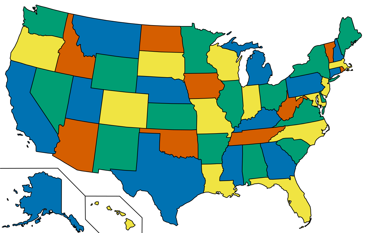
English: A map of the United States showing four colors. According to the Four color theorem, only four colors are needed to complete a map containing any type of shapes provided that two touching shapes share a border of at least two points (a line).
This colouring is not the only way to four-colour the map: for example, Florida could be orange. This graphic uses a colour palette accessible to colour blind people. |
| Data | |
| Burimi |
This file was derived from: Map of United States vivid colors shown.svg |
| Autori | w:User:Derfel73, w:User:Dbenbenn, w:User:Strangerpete, inductiveload |
This image relies, or partly relies, on colours convey information. The colors used have been chosen to remain visually distinct even to viewers with colour blindness. When modifying this image, make sure that the result remains accessible to colour-blind users.
|
Licencim
Kjo skedë licencohet sipas Creative Commons Attribution-Share Alike 3.0 Unported.
- Je i lirë të:
- ta shpërndani – ta kopjoni, rishpërndani dhe përcillni punën
- t’i bëni “remix” – të përshtatni punën
- Sipas kushteve të mëposhtme:
- atribuim – Duhet t’i jepni meritat e duhura, të siguroni një lidhje për tek licenca dhe të tregoni nëse janë bërë ndryshime. Këtë mund ta bëni në ndonjë mënyrë të arsyeshme, por jo në ndonjë mënyrë që sugjeron se licencuesi ju del zot juve apo përdorimit tuaj.
- share alike – Nëse bëni një “remix”, e shndërroni, ose ndërtoni duke u bazuar te materiali, duhet t’i shpërndani kontributet tuaja sipas të njëjtës licencë ose një të tille të përputhshme me origjinalen.
Historiku i skedarit
Kliko mbi një datë/orë për ta parë skedarin siç është shfaqur në atë kohë.
| Data/Ora | Miniatura | Përmasat | Përdoruesi | Koment | |
|---|---|---|---|---|---|
| e tanishme | 24 janar 2022 16:02 | | 548 × 349 (126 KB) | wikimediacommons>Inductiveload | c:User:Rillke/bigChunkedUpload.js: |
Përdorimi i skedarit
faqe lidhet tek kjo skedë: