Skeda:Map of the full sun.jpg
Kërceni tek navigimi
Kërceni tek kërkimi
Madhësia e këtij shikimi: 800 × 400 pixel. Rezolucione të tjera: 320 × 160 pixel | 640 × 320 pixel | 1.024 × 512 pixel | 1.280 × 640 pixel | 3.000 × 1.500 pixel.
Skedari origjinal (3.000 × 1.500 pixela, madhësia e skedës: 1,07 MB, tipi MIME: image/jpeg)
Përmbledhje
| Përshkrimi |
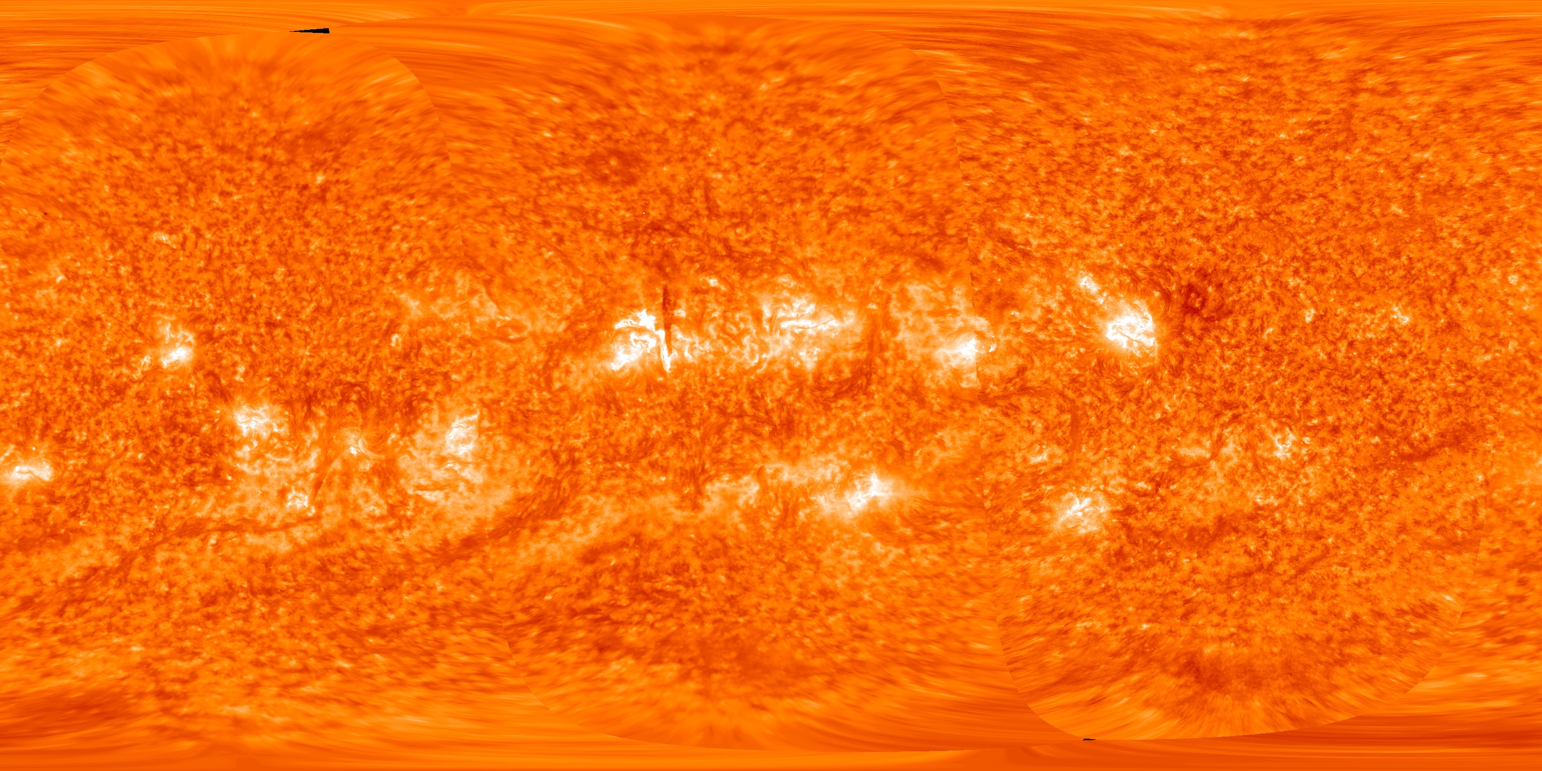
English: This map of the full sun on 14 October 2012 was created by spacecraft images from, in order from left to right, STEREO-A, STEREO-B and the Solar Dynamics Observatory The dark vertical line near the centre of the picture is an overhead view of a solar prominence (see File:STEREO view of solar prominence on 2012-10-14.jpg for explanation). |
| Data | |
| Burimi | STEREO Reaches New Milestone At Its Sixth Anniversary |
| Autori | NASA/STEREO/SDO/GSFC |
Licencim
| This file is in the public domain in the United States because it was solely created by NASA. NASA copyright policy states that "NASA material is not protected by copyright unless noted". (See Template:PD-USGov, NASA copyright policy page or JPL Image Use Policy.) | ||
 |
Warnings:
|
Historiku i skedarit
Kliko mbi një datë/orë për ta parë skedarin siç është shfaqur në atë kohë.
| Data/Ora | Miniatura | Përmasat | Përdoruesi | Koment | |
|---|---|---|---|---|---|
| e tanishme | 16 mars 2013 02:45 | | 3.000 × 1.500 (1,07 MB) | wikimediacommons>Spideog | User created page with UploadWizard |
Përdorimi i skedarit
faqe lidhet tek kjo skedë: